Loading...
February 18, 2010#

Bing Maps Making an Impression

It’s not often that I write an actual post about something I just came across on the net. Usually I just share interesting news via Google Reader here and the ‘Feed Favs’ section on my front page, but this is something I was so impressed by that I just want to show you the video right here without much talk.

Microsoft has become quite innovative in my opinion over the past months. Ranging from creative, refreshing and productivity boosting changes and features in Windows 7, to an actually competitive new search engine called Bing and the recently announced Windows 7 Phone Series with a quite unexpected look & feel, Microsoft apparently also wants a piece of that online maps cake. The following video, which I came across here, shows some of the latest (yet to be published) features of Bing Maps, some of which a rather impressive and astonishing than just cheap copies of what Google Maps offers.

But see for yourself:

June 1, 2008#

Update: What OpenStreetMap doesn’t have…

I didn’t actually think about this when I “rediscovered” OpenStreetMap the other day and wrote my blog post about it; there’s yet another feature that OpenStreetMap doesn’t offer… routing! I didn’t really notice that as I’m hardly using this feature on Live Maps or Google Maps, but in fact, there’s no from-to route finding service on OSM.

BUT luckily there is OpenRouteService, a free routing service that is based on (as you may guess) OpenStreetMap. Another great example of what to do with a free worldwide street database ;-)

May 26, 2008#

OpenStreetMap! A great idea!

Mag_map-120x120I’d like to help and spread the word about a project I actually came across quite a while ago but which I’ve rediscovered recently: OpenStreetMap (German version here). In short, this project is a community effort to create a copyright-free world map.

The look and feel is basically the same as with Google Maps (without the satellite coverage of course) but the big difference is, that OpenStreetMap maps are completely free. Not like Google’s maps which are “free” as in “you can do this and that with our maps BUT YOU’RE NOT ALLOWED TO …………………. <LONG TEXT FOLLOWING> …………”.

osmOf course they don’t have all the features of the big players like Google or Microsoft; there’s no Street View, no Bird’s Eye View and sadly but understandably  no satellite coverage but the maps (and the data behind them) are completely free and you can use them for practically anything. You can even download the world database which the maps are based on onto your computer and use it for whatever you like. Besides, in some of the more crowded areas, OpenStreetMap maps are even more accurate then Google’s version, as you can see in the following picture. Continue Reading

February 11, 2008#

Planes’ and Trains’ Locations! Live!

As I myself already got some experience with using Google Maps and Earth to display things such as stars (Web-based Planetarium) or Flight Simulator X aircrafts (FSXGET), I really like those two applications I’ve came over yesterday:

They’re both based on Google Maps, with the first one showing the realtime positions of Swiss trains…

train

… and the second doing the same for planes over Zurich.

flight

Absolutely awesome! The latter one comes really close to FSXGET just for the real world and looking at the technique behind reminds me of a passive radar I’ve seen in action during a visit to INDRA‘s plant in Madrid.

Besides, since my internship at AENA, I somehow just enjoy looking at realtime maps with planes moving around ;-)

January 26, 2008#

Thanks for your help starryalley

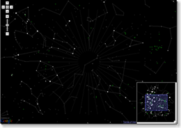
planetarium-thumbI’ve just found out that one of my projects, a web-based planetarium found a mention on a Taiwanese blog. It’s the blog of a programmer from Taiwan whose application I used in my project and who helped me out with some problems I had when trying to adapt his application to my needs.

You can see his blog entry about my project here. But anyway, I’d like to use that chance to thank him again for his help. He did really save me a lot of time just as did his application.

So, thanks again starryalley for your help and keep up such a good work with mobile starchart.

March 8, 2007#

Take a close look with Google Maps!

As this article reports, some bloggers have found that Google Maps can be tweaked to show higher resolution images of at least certain regions of the world. This works only for very few regions but nevertheless, this example presents a quite astonishing view.